Photographic Survey

---- Monitoring Troopers Hill 1994 to 2021 ----

See also: Troopers Hill Through the Seasons - Troopers Hill in the 1960s - Troopers Hill - 1998 to 2012 - Troopers Hill Management Plan

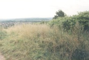
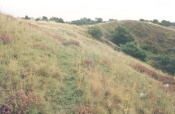
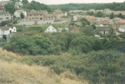
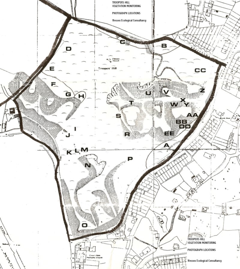
The photos below were taken as part of an ongoing photographic survey of Troopers Hill undertaken for Bristol City Council by Rupert Higgins of Wessex Ecological Consultancy and the Friends of Troopers Hill.

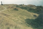
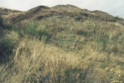
35 photographs are taken from fixed points on the hill so that changes in the spread of different plant species can be monitored. From 1994 to 2008 they were taken every other year. An extra photo was added in 2011.

In 2010 it was agreed to move to 5 year cycle for the photo survey to match the review dates of the Management Plan so the survey was delayed until 2011. This was in view of the increased site presence of Bristol Parks and Friends of Troopers Hill monitoring vegetation as part of ecological management.

The 2016 survey was used to help update the Management Plan in 2019. All these surveys were funded by Bristol City Council. The 2021 survey has also now been completed - funded by Friends of Troopers Hill.

As part of the 2021 survey a list of the What Three Word location for each photo was produced.

For six of these photos we have uploaded the full set of photos since 1994. Clicking on the thumbnails below will allow you to click through to see the photos from all the surveys 1994 to 2016 together with a more detailed description of the changes that can be seen. The photographs are taken in August each year.


Photo 04


Spread of Japanese Knotweed


Photo 09


Broom affected by 1995 fire


Photo 13


Spread of Heather


Photo 19


Spread of Bramble into Broom


Photo 20


Area of erosion and recovery of heather after 1995 fire


Photo 33


Spread of Ling, Heather and Broom

 Location Map for the above photographs.

The changes on part of Troopers Hill since May 2006 can also be seen on our 'Through the Seasons' page where there are photos of the hill taken monthly from the same spot. A comparison with a similar view from 1998 can be seen here.

For a longer term view of the changes on the hill you can look at some of the photographs of the hill on our Old Photographs page. Some of the sets have a Then & Now feature to let you see how the vegetation has changed over time. We also have two photographs of Troopers Hill in the 1960s which were posted on facebook.

2021 Survey

Rupert Higgins of Wessex Ecological Consultancy repeated the survey for the tenth time in 2021.

The major changes revealed (similar to those that were identified in 2016) were:

• Increased Heath Cover

• Tree and Scrub Encroachment

• Increase in Goldenrod

Some additional photos were taken for this survey to better show areas where the original location could not be accessed or the view is now obscured.

The report (below) includes a list of What Three Word locations for all the photos.

 Full Report on photo survey - 2nd September 2021
 What Three Word location list only

2016 Survey

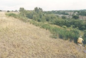
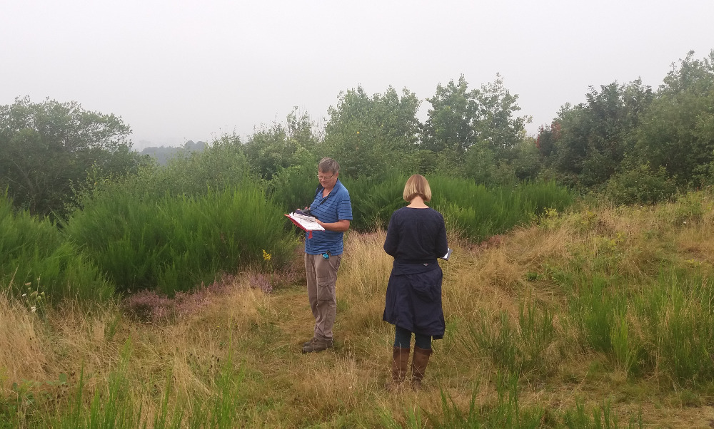
Rupert Higgins of Wessex Ecological Consultancy took the photos for the 2016 survey on 25th August. Becky Belfin, Nature Conservation Officer for Bristol City Council and Rob Acton-Campbell of Friends of Troopers Hill joined him to discuss some of the issues raised.

The report can be seen below.

 Report on photo survey - August 2016

2011 Survey

The report and photos from the 2011 survey can be seen via the links below:

 Report on photo survey - August 2011

 Map showing areas refered to in the reports

 2011 Photos - numbers 1 to 8

 2011 Photos - numbers 9 to 16

 2011 Photos - numbers 17 to 22

 2011 Photos - numbers 23 to 28

 2011 Photos - numbers 29 to 35

2008 Survey

 Report on photo survey - September 2008

 2008 Photos - numbers 1 to 17

 2008 Photos - numbers 18 to 35

2006 Survey

The photographs for 2006 were taken by Friends of Troopers Hill during our Work Party on 5th Aug. To help get an overall view of how the hill had changed, we put together some pages showing the 2006 photographs alongside the 1994 set. These can be seen via the links below:

Photos 1 to 11  | Photos 12 to 22  | Photos 23 to 35

 Report on photo survey - August 2006

1994 to 2004 Reports

The written reports produced with the earlier surveys are availble for download below along with maps showing the photo locations and the areas refered to in the reports:

 Report on photo survey - August 2004
 Report on photo survey - August 2002
 Report on photo survey - August 2000
 Report on photo survey - August 1998
 Report on photo survey - August 1996
 Report on photo survey - August 1994
 Description of photo locations - August 1994 (applies to all photo reports)
 Map of photo locations - August 1994 (applies to all photo reports)
 Map of areas - August 1994 (applies to all photo reports)

See also: Troopers Hill Through the Seasons - Troopers Hill in the 1960s - Troopers Hill - 1998 to 2012 - Troopers Hill Management Plan

▲ Top of page